LAKE NORMAN
Location
![map[1].gif (8625 bytes)](images/map%5b1%5d.gif)
Lat/Long:
N 35-36.85; W 080-54.02
Elevation: 838 ft. Variation: 5 West
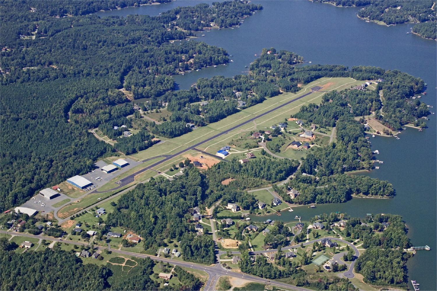
Airport
Operations
Facility: Privately owned public use Pattern Altitude: 1700ft MSL
Sectional Chart:
Control Tower:
ARTCC: Charlotte
Approach Lights: Dusk to Dawn
FSS:
NOTAMS: Raleigh Flight Service Landing Fee: None
Airport
Communications
CTAF: 122.8 USE IT
UNICOM: NONE
DEPARTURES: Runway
14: IMMEDIATE right turn heading 160 degrees
Avoid flying over school.
Runway 32: Maintain runway heading until over the lake.
PAPI: Both ends of runway. Both are
set for a 4 degree glide slope.
On
continuously from 5:30 PM until 7:30 AM.
PAPI for 14 is on right side of runway.
PAPI for 32 is on the left side of the runway.
Runway Information
![]()
Runway 14/32: 3000 x 40 ft. (Rwy 14 Threshold
displaced by 175 feet)
Surface: New Asphalt.
Lighting: PCL (3, 5, or 7 clicks). New lighting
has been installed on GA Taxiways.
USE
CAUTION on GA Taxiways at night as they may have motor vehicle
traffic.
SERVICES
Fuel,
tie downs, or other questions, call 704-662-6227 0800 till 2000 hours
7 days a week.
This
data is NOT to be used for flight operations. Airmen should check the
current Facilities Directory and NOTAMS to
ensure that they have the latest information available for flight planning.